Fort Frances Lookout Tower Original Site
CAN 1, ON 1
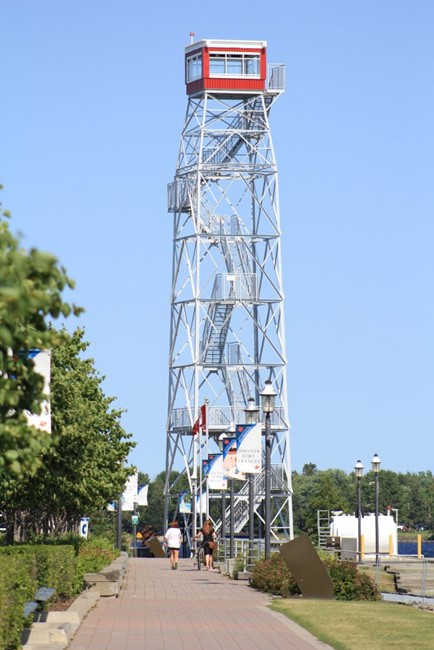
Tower after relocation to Fort Frances
Lookout Details
| Registry Numbers | CAN 1, ON 1 (view other lookout sites in Canada, Ontario) |
| Date Registered | December 31, 2023 |
| Nominated by | William Haddad |
| Location | Kenora District, Ontario |
| Coordinates |
N 49° 09.760' W 093° 19.557' (view using Google Maps) N 49° 09' 46" W 093° 19' 33" N 49.162669° W 093.325948° |
| Elevation | 1,290 ft (393 m) |
Description
This tower was originally constructed in the 1930s in a remote Atkikokan, Ontario where it served as a forest fire lookout and radar tower. It was relocated to Fort Frances in 1972 to be used as a tourist attraction. In 2009, it was moved again to its current location along the Rainy River.
Map
Change Basemap