Lexington Hill Lookout Site
US 1988, CA 116
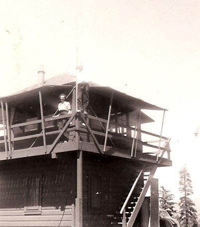
Lexington Hill Lookout
Lookout Details
| Registry Numbers | US 1988, CA 116 (view other lookout sites in United States, California) |
| Date Registered | April 10, 2020 |
| Nominated by | Brad Eells |
| Location |
Plumas National Forest Plumas County, California |
| Coordinates |
N 39° 40.717' W 121° 00.591' (view using Google Maps) N 39° 40' 43" W 121° 00' 35" N 39.678612° W 121.009847° |
| Elevation | 5,777 ft (1,761 m) |
| Built | 1933/1961 |
| Removed | 1983 |
| Administered by | US Forest Service - Plumas National Forest |
Description
The original structure was built in 1933, a California Region 5 Plan BC-301 on a 10 enclosed timber tower. The tower was replaced in 1961 with a CL-100 on a 20 foot K-Brace open steel tower.
The second lookout and tower were dismantled and installed on Pike County Peak in 1983, where it still serves as a fire detection site today.
Map
Change Basemap
Photos
September 1933