Madulce Peak Lookout Site
US 1856, CA 51
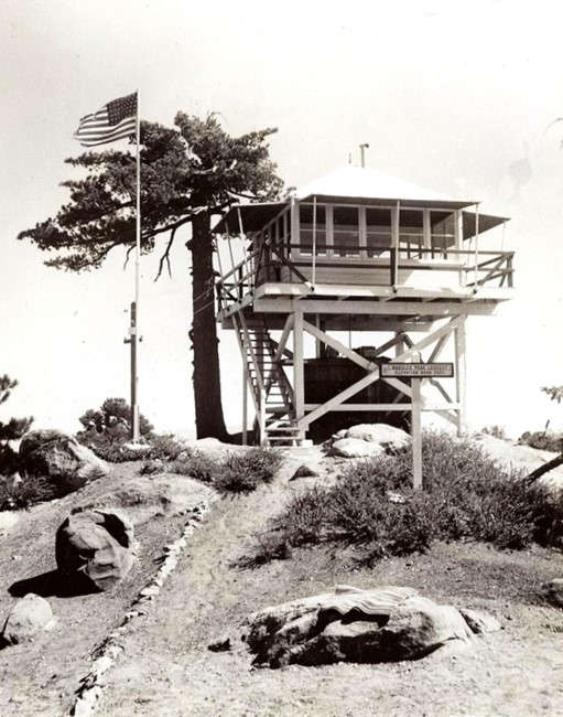
Madulce Peak Lookout - 1937
Lookout Details
| Registry Numbers | US 1856, CA 51 (view other lookout sites in United States, California) |
| Date Registered | December 19, 2019 |
| Nominated by | Brad Eells |
| Location |
Los Padres National Forest Santa Barbara County, California |
| Coordinates |
N 34° 41.462' W 119° 35.473' (view using Google Maps) N 34° 41' 28" W 119° 35' 28" N 34.691037° W 119.591221° |
| Elevation | 6,543 ft (1,994 m) |
| Built | 1934 |
| Removed | 1972 |
| Administered by | US Forest Service - Los Padres National Forest |
| Cooperators | Santa Barbara National Forest |
Description
The structure was built in 1934 for the Santa Barbara National Forest, a California Region 5 Plan BC-301 on a 10 foot, open timber tower. This lookout replaced an earlier structure destroyed by fire in September 1932.
The lookout was destroyed in a 1972 windstorm that took off the roof then collapsed the walls. The remainder of the structure was removed sometime after the event.
The site is now part of the Los Padres National Forest in Santa Barbara County.
Map
Change Basemap
Photos
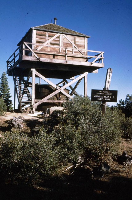
1963
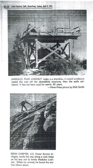
Destroyed 1972