Mendenhall Peak (Highline) Lookout Site
US 1793, CA 39
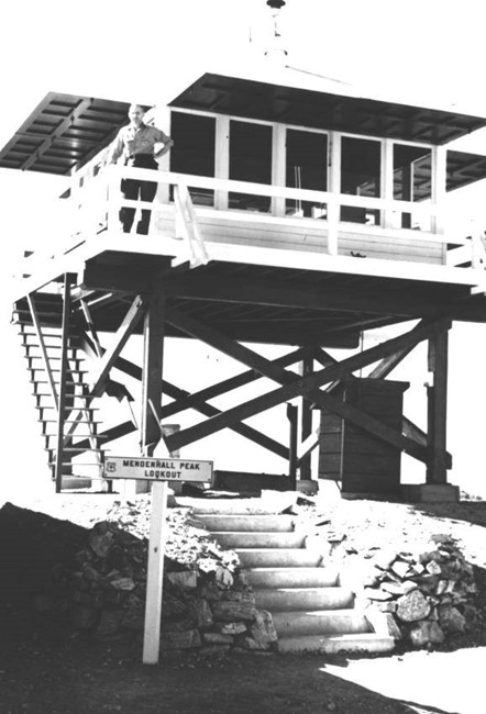
Mendenhall Peak (Highline) Lookout
Lookout Details
| Registry Numbers | US 1793, CA 39 (view other lookout sites in United States, California) |
| Date Registered | November 3, 2019 |
| Nominated by | Brad Eells |
| Location |
Angeles National Forest Los Angeles County, California |
| Coordinates |
N 34° 20.977' W 118° 18.739' (view using Google Maps) N 34° 20' 59" W 118° 18' 44" N 34.349622° W 118.312309° |
| Elevation | 4,639 ft (1,414 m) |
| Built | 1937 |
| Removed | 1975 |
| Administered by | US Forest Service - Angeles National Forest |
Description
Mendenhall Peak Lookout was also known as Highline Lookout. The lookout was constructed in 1937, a California Region 5 Plan BC-301 Cabin atop a 10 foot open timber tower.
The lookout was destroyed in the Big Tujunga Fire in 1975 and was not rebuilt.
Map
Change Basemap