Mount Pinos - Aircraft Warning Service Site
Lookout Details
| Registry Numbers | US 2016, CA 133 (view other lookout sites in United States, California) |
| Date Registered | April 16, 2020 |
| Nominated by | Brad Eells |
| Location |
Los Padres National Forest Ventura County, California |
| Coordinates |
N 34° 48.768' W 119° 08.722' (view using Google Maps) N 34° 48' 46" W 119° 08' 43" N 34.812803° W 119.145364° |
| Elevation | 8,847 ft (2,697 m) |
| Built | 1942-43 |
| Removed | Unknown |
| Administered by | US Forest Service - Los Padres National Forest |
| Cooperators | United States Army Ground Observer Corps |
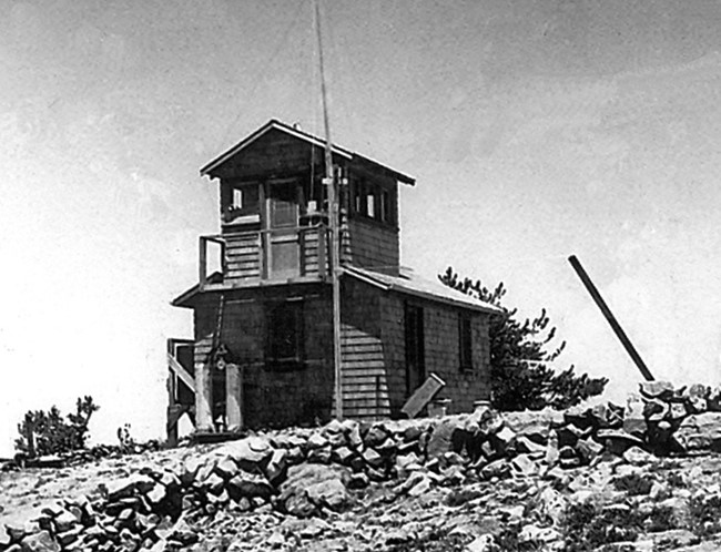
Description
Forest fire detection was occurring as early as 1927 according to newspaper reports. It is unknown if any structure was built prior to WWII.
The Mount Pinos structure was a dual purpose site, used for enemy aircraft spotting and fire detection. A standard AWS post structure with a ground cabin and cupola were constructed in 1942/43.
The US Forest Service built, provisioned and staffed these posts. The US Army reimbursed the US Forest Service for all costs. Operators were expected to report all aircraft activities and report all fires and smokes to USFS dispatch. Aircraft information was then relayed to the Army.
Fire detection may have continued after WWII. Building removal date is unknown.