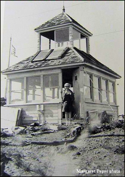
Battle Axe Lookout Site
US 570, OR 11
Lookout Details
| Registry Numbers | US 570, OR 11 (view other lookout sites in United States, Oregon) |
| Date Registered | August 16, 2010 |
| Nominated by | Ray Kresek |
| Location |
Mount Hood Region Marion County, Oregon |
| Coordinates |
N 44° 49.600' W 122° 08.380' (view using Google Maps) N 44° 49' 36" W 122° 08' 23" N 44.826670° W 122.139660° |
| Elevation | 5,558 ft (1,694 m) |
| Administered by | U.S. Forest Service |
Description
The first lookout on this site was a camp built by the USFS in 1912. In 1925, this was replaced by a cupola cabin. A 6' enclosed L-4 tower was built in 1951 and was removed in 1969
Map
Change Basemap