Foreman Point Lookout Site
US 595, OR 36
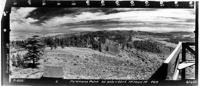
Foreman Point Lookout panoramic 6-16-40
Lookout Details
| Registry Numbers | US 595, OR 36 (view other lookout sites in United States, Oregon) |
| Date Registered | August 24, 2010 |
| Nominated by | Ray Kresek |
| Location |
Mount Hood Region Wasco County, Oregon |
| Coordinates |
N 45° 05.227' W 121° 24.061' (view using Google Maps) N 45° 05' 14" W 121° 24' 04" N 45.087110° W 121.401010° |
| Elevation | 3,498 ft (1,066 m) |
| Administered by | Oregon Department of Forestry |
Description
The Oregon Department of Forestry built a 14' pole live-in tower on this site in 1937. That was replaced by a 41' treated timber L-4 tower in 1951, which is now gone.
Map
Change Basemap
Photos
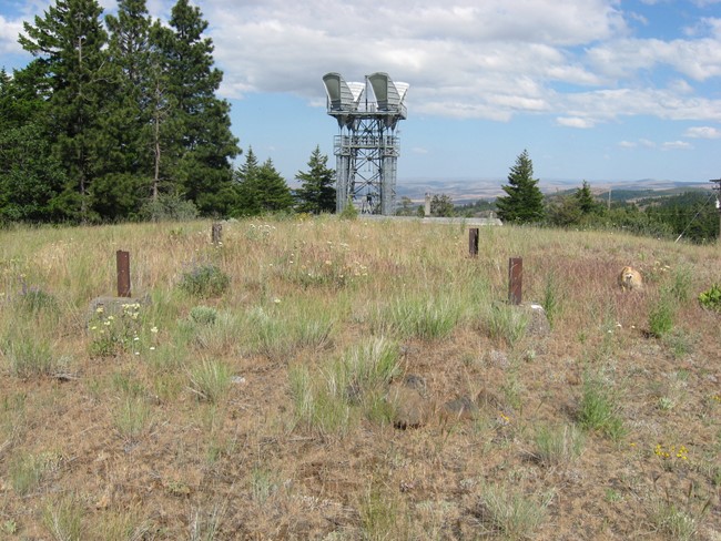
Foreman Point Lookout site 2011