Mount McLoughlin Lookout Site
US 883, OR 250

Lookout Details
| Registry Numbers | US 883, OR 250 (view other lookout sites in United States, Oregon) |
| Date Registered | March 26, 2011 |
| Nominated by | Ray Kresek |
| Location |
Rogue River National Forest Jackson County, Oregon |
| Coordinates |
N 42° 26.668' W 122° 18.937' (view using Google Maps) N 42° 26' 40" W 122° 18' 56" N 42.444470° W 122.315620° |
| Elevation | 9,495 ft (2,894 m) |
| Administered by | U.S.Forest Service |
Description
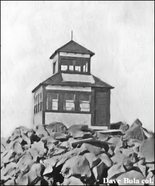
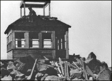
Built in 1917, this cupola cabin was declared unsafe in the 1930s and was replaced by a more solidly built cupola lookout, which was used about one season and abandoned and was finally removed in 1955.
Map
Change Basemap
Photos

Lookout under construction in 1917