Joe's Point Lookout Site
US 1601, WA 440
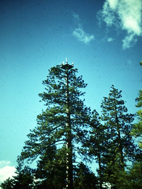
1959 Dennis Lynch photo
Lookout Details
| Registry Numbers | US 1601, WA 440 (view other lookout sites in United States, Washington) |
| Date Registered | August 30, 2015 |
| Nominated by | Dennis Lynch |
| Location |
Mount Hood National Forest Wasco County, Oregon |
| Coordinates |
N 45° 25.636' W 121° 25.233' (view using Google Maps) N 45° 25' 38" W 121° 25' 14" N 45.427267° W 121.420554° |
| Elevation | 3,731 ft (1,137 m) |
| Administered by | U.S. Forest Service |
Description
This lookout was a platform on top of a Ponderosa pine tree. It likely predated construction of formal lookouts and was still in existence in 1962.
Map
Change Basemap