Miller Mountain Lookout Site
US 1511, WA 411
Miller Mountain Lookout site
Lookout Details
| Registry Numbers | US 1511, WA 411 (view other lookout sites in United States, Washington) |
| Date Registered | December 16, 2012 |
| Nominated by | Ray Kresek |
| Location |
Spokane Indian Reservation Stevens County, Washington |
| Coordinates |
N 48° 00.373' W 118° 19.333' (view using Google Maps) N 48° 00' 22" W 118° 19' 20" N 48.006210° W 118.322220° |
| Elevation | 3,115 ft (949 m) |
| Administered by | Spokane Indian Reservation |
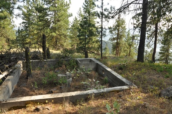
Description
Built in 1932, the first lookout was a 3-legged wooden tower with 7x7' cab, a tent and a cabin. This was followed in 1934 with an L-4 cab living quarters. The lookout was removed in 1962.
Map
Change Basemap
Photos
Miller Mountain Lookout site