Ball Mountain Lookout (Tehama County)
US 2044, CA 150
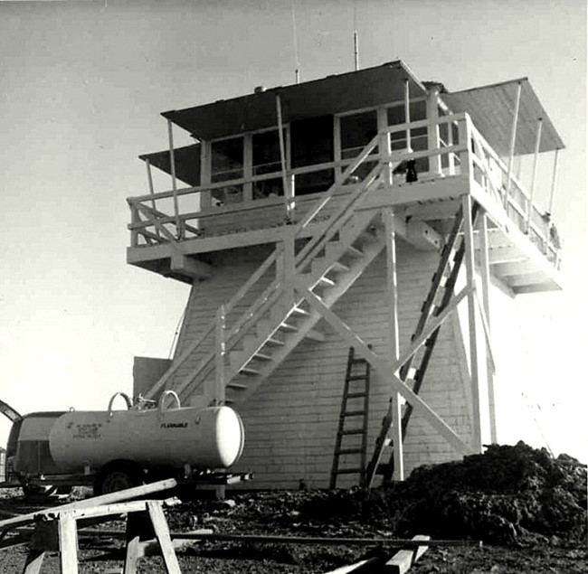
Ball Mountain Lookout - 1965
Lookout Details
| Registry Numbers | US 2044, CA 150 (view other lookout sites in United States, California) |
| Date Registered | April 23, 2020 |
| Nominated by | Brad Eells |
| Location |
Mendocino National Forest Tehama County, California |
| Coordinates |
N 39° 55.904' W 122° 47.097' (view using Google Maps) N 39° 55' 54" W 122° 47' 06" N 39.931736° W 122.784952° |
| Elevation | 6,567 ft (2,002 m) |
| Built | 1935 |
| Removed | Unknown |
| Administered by | US Forest Service - Mendocino National Forest |
Description
Ball Mountain was built for the Mendocino National Forest in 1935. The structure was a California Region 5 Plan BC-301 cabin on a 20 foot enclosed timber tower.
Removal date is unknown, only the foundation remains at the site.
Map
Change Basemap