South Fork Mountain Lookout Site - 2005
Lookout Details
| Registry Numbers | US 1884, CA 79 (view other lookout sites in United States, California) |
| Date Registered | December 29, 2019 |
| Nominated by | Brandi Boesiger |
| Location | Shasta County, California |
| Coordinates |
N 40° 39.246' W 122° 31.500' (view using Google Maps) N 40° 39' 15" W 122° 31' 30" N 40.654093° W 122.525002° |
| Elevation | 3,450 ft (1,052 m) |
| Built | 1982 |
| Removed | Unknown |
| Administered by | California Department of Forestry and Fire Protection - Shasta-Trinity Unit (Cal Fire SHU) |
Description
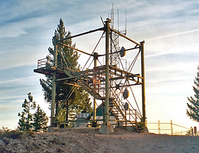
South Fork Mountain was constructed in 1982.
CDF engineer, Mike Plesha, designed this tower (Plan No. 1559-2A). The tower's legs are 911 square (hollow) steel columns which were originally intended for use in the construction of above ground, atomic bomb testing towers (the bombs were dropped from the towers). With cessation of those tests, the General Services Administration sold the unused materials. This was the third tower CDF constructed using these materials. The steel tower is topped with a 732-6A (Plesha design) cab. The lookout is an excellent example of a low maintenance, high vandal proof building type.
South Fork Mountain is a southeast tending ridge situated in the rugged country north of the Whiskeytown-Shasta-Trinity National Recreation Area. The lookout is located upon "South Mountain" a peak near the southern end of the ridge. The area is covered in pine, oak, fir and brush. There are two communications vaults and a three pole radio tower assembly on the northeast side of the lookout. A repeater antenna is attached to the cab. Electromagnetic radiation is extremely high around the lookout catwalk. The site is accessible to the public, being 6.7 miles from paved road. (MVT 10/91)
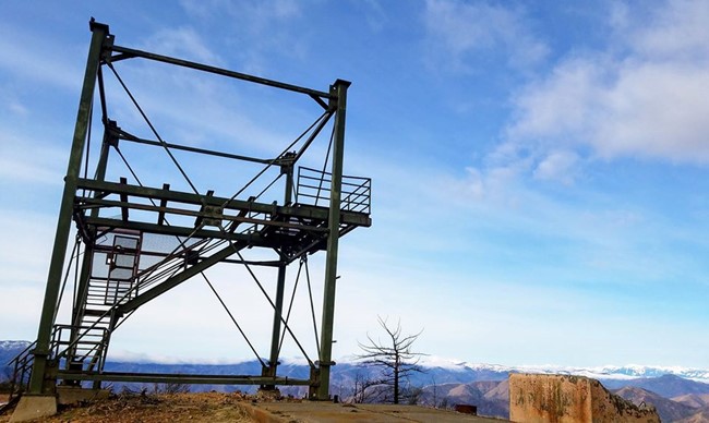
The cabin and storage structure were removed at an unknown date, only the tower remains.
Map
Photos
2019